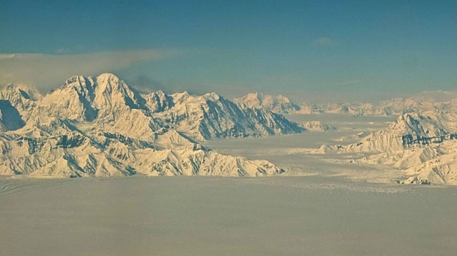
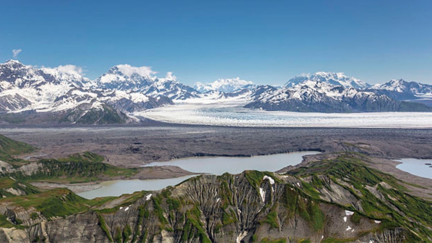
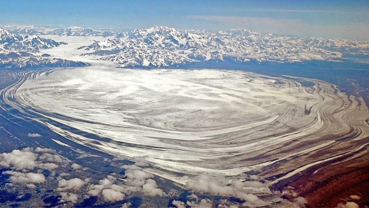
Malaspina Glacier: A Geographic Titan
Covering approximately 1,680 square miles and located in Wrangell-St. Elias National Park in Southeastern Alaska, the Malaspina Glacier is North America’s largest glacier and the world’s largest piedmont glacier.
Source: Wikimedia Commons
Distinguished by its lobed form, this type of glacier spreads out from mountainous regions onto flatter land. It is a significant geographical feature in the region thanks to its enormous size and unique shape.
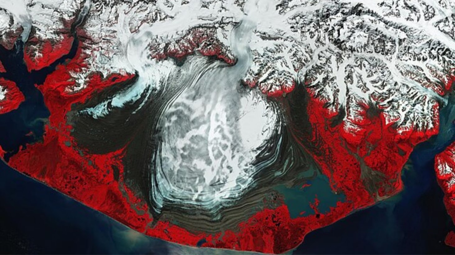
Interpreting NASA's Colorful Image
NASA’s image of Malaspina Glacier uses false-color imaging to differentiate between various elements of the glacier. In this technique, infrared radiation helps distinguish between ice, water, land, and vegetation.
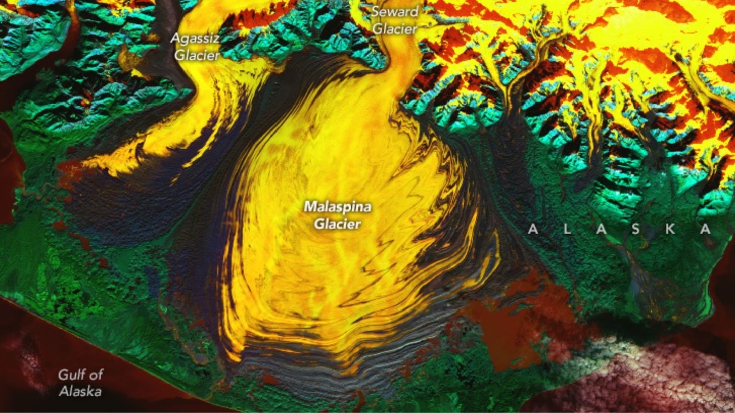
Source: Wanmei Liang/Landsat/NASA Earth Observatory
The yellow and orange hues represent ice, red indicates water, and blue and green colors mark land and vegetation, respectively. This method provides valuable insight into the glacier’s composition.
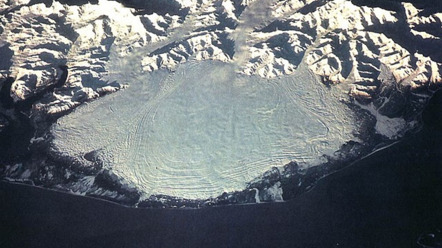
The Discovery of a Hidden Lagoon
The recent image has revealed a ‘hidden lagoon’ located between the ice and land at the glacier’s edge. This body of water is unique due to its saltwater composition, which is warmer than previously thought.
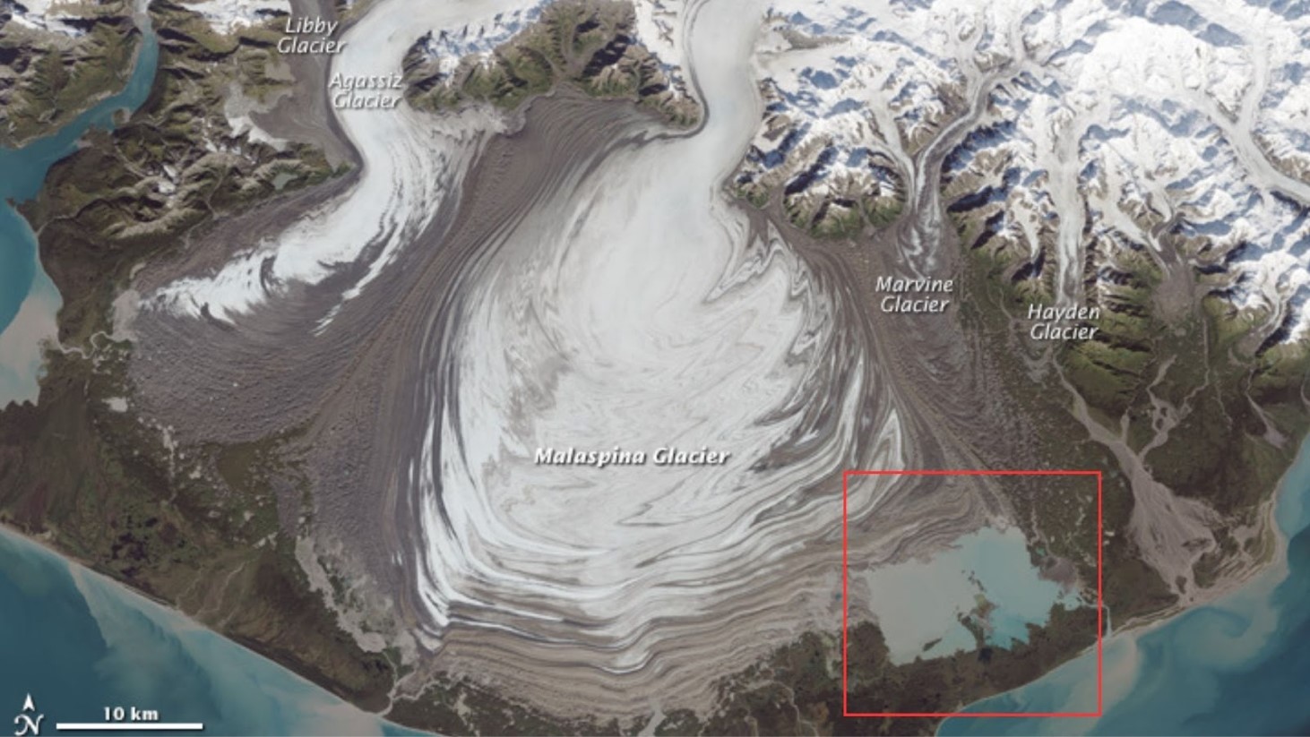
Source: Jesse Allen/Landsat/NASA Earth Observatory
The discovery of this lagoon is important, as it could have consequences for the current understanding of glacial melting processes.
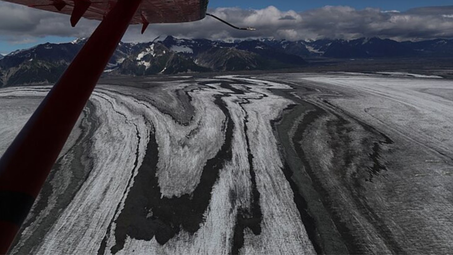
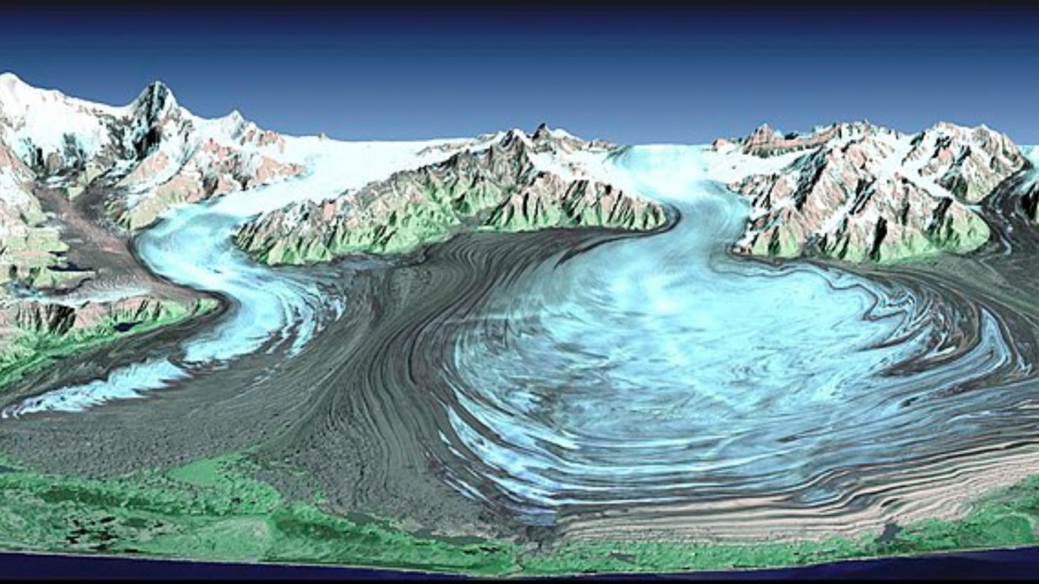
Malaspina's Moraines: A Geological Record
The ripples and folds visible on the surface of Malaspina Glacier are moraines, which are bands of soil, rock, and debris. These features are formed as the glacier moves and collects material along its path.
Source: Wikimedia Commons
Moraines serve as a geological record, providing evidence of the glacier’s historical movements and the natural processes that are involved in shaping it.
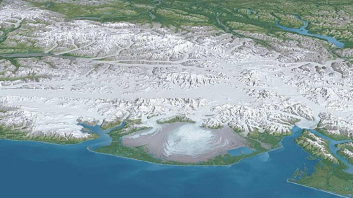
Adjacent Glaciers: Seward and Agassiz
In addition to Malaspina, the satellite image also shows nearby glaciers, namely the Seward and Agassiz Glaciers.
Source: Wikimedia Commons
These glaciers, fed by the Saint Elias Mountains, are part of the same glacial system and contribute to the overall understanding of glacial behavior in the region.
Reassessing Malaspina's Ice Volume
A study published in the Journal of Geophysical Research: Earth Surface has shown that the volume of Malaspina Glacier’s ice had previously been overestimated by about 30%.
Source: Wikimedia Commons
Despite this, the study suggests that a complete melt of the glacier could raise global sea levels by 0.06 inches, highlighting the potential impact of glacial melting on global sea levels.
Saltwater Lagoon's Impact on Ice Melt
The saltwater lagoon discovered within the glacier is warmer due to its high salt content. This characteristic of the lagoon is crucial as it could influence the rate at which the surrounding ice melts.
Source: Wikimedia Commons
The presence of such warm water bodies within glaciers is an important factor in studying glacial dynamics.
Subglacial Water Channels: An Underlying Network
Researchers have also identified extensive subglacial channels running through the bedrock beneath Malaspina Glacier.
Source: Wikimedia Commons
These channels, extending up to 22 miles under the ice, play a notable role in the glacier’s movement and melting patterns.
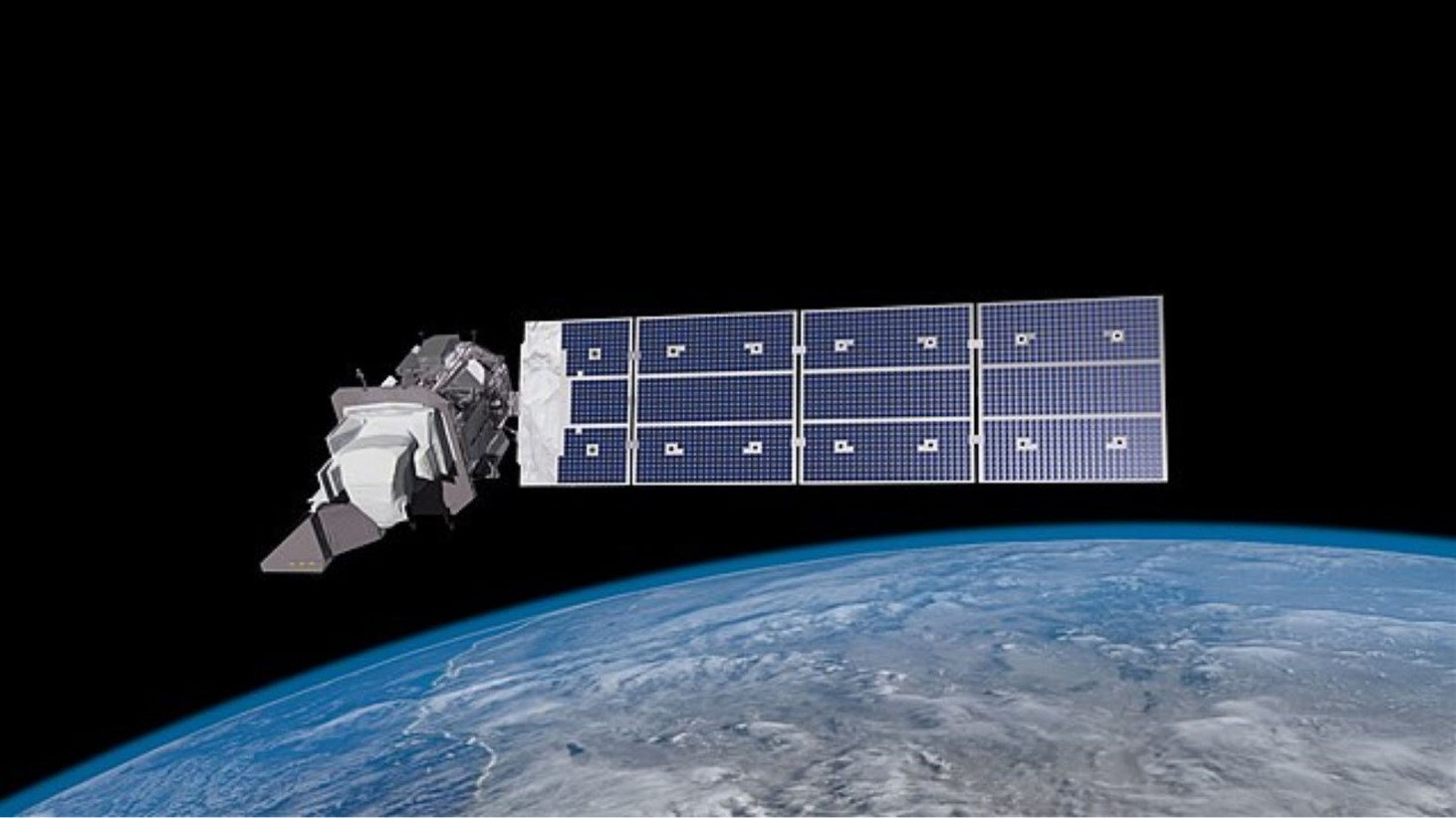
A Window into Earth's Glaciers
The Landsat 9 satellite, a joint project between NASA and the U.S. Geological Survey was instrumental in capturing this detailed image of Malaspina Glacier.
Source: Wikimedia Commons
The satellite’s ability to provide such high-resolution, false-color images is invaluable in studying Earth’s natural features and keeping an eye on environmental changes.
The Glacier's Indigenous Name
The Malaspina Glacier is also known by its indigenous name, Sít’ Tlein, which means ‘big glacier’ in the Tlingit language.
Source: Wikimedia Commons
This name, given by the Indigenous people of the area, reflects the cultural significance of the glacier and the deep connection between the natural world and local communities.
Global Implications of Malaspina Glacier's Study
The study of Malaspina Glacier extends beyond its geographical and environmental aspects. Understanding this glacier, its behavior, and its changes is crucial in the broader context of climate research and sea-level studies.
Source: Wikimedia Commons
The insights gained from Malaspina Glacier contribute to the global understanding of glacial dynamics and their implications for Earth’s climate system.